Take a Photo. AI Fills the Form
Your inspector takes a photo of any asset or defect. AI reads it and fills the inspection form automatically. No typing. No manual entry.

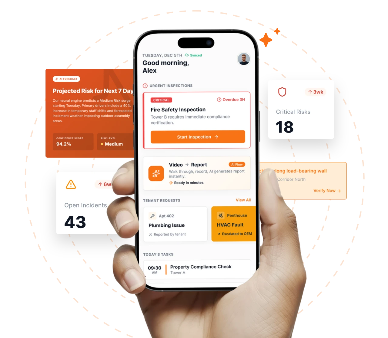
Convert your checklist into Mobile App
Geofencing in Inspectly360 gives operations teams proof that inspections happen where they should. When you manage inspections across many sites, you cannot personally confirm that an inspector was actually on location. Geofencing solves this by drawing digital boundaries around any site, building, or zone, then automatically verifying inspector presence with GPS. Every inspection, photo, and note is timestamped and GPS-stamped, building a complete location audit trail. The system can also auto check-in inspectors and load the correct site-specific checklist on arrival, so accountability and the right workflow come together.
Define custom boundaries around any site, building, floor, or zone, using circles, polygons, or custom outlines.
Explore FeatureEvery inspection record, photo, and note is tagged with precise GPS coordinates and a timestamp.
Explore FeatureThe app detects when inspectors enter or leave a geofenced site and logs arrival and departure times.
Explore FeatureThe right checklist loads automatically when inspectors arrive. Site-specific templates open without manual selection.
Explore FeatureA global location directory holds every site, building, and zone, so you manage inspection requirements across the portfolio.
Explore FeatureA visual map shows all inspection activity across the portfolio, filterable by date, status, inspector, or compliance score.
Explore FeatureA manager defines a digital boundary around each site, building, floor, or zone using a circle, polygon, or custom outline on the map.
When the inspector enters the geofenced area, the app auto checks them in, logs the arrival time, and loads the site-specific checklist.
As the inspector works, every checklist entry, photo, and note is tagged with GPS coordinates and a timestamp.
On submit, the system confirms the inspection was completed inside the boundary, or flags the discrepancy for a manager to review.
Facilities managers define geofences around each building in their portfolio. When inspectors arrive, the correct checklists load automatically, and GPS stamps verify every inspection was completed on-site.
General contractors set geofences around active job sites. Safety inspectors can only complete daily walk-through checklists while physically inside the site boundary.
Utility companies define geofences along pipeline routes and around substations. Field inspectors follow GPS-guided routes, and the system confirms each inspection point was physically visited.
Everything your field team does on paper, Inspectly360 does automatically: faster, more accurate, and without the admin.
Your inspector takes a photo of any asset or defect. AI reads it and fills the inspection form automatically. No typing. No manual entry.

Inspectors speak their observations in any language. AI transcribes and fills the form in real time. Completely hands-free in the field.

The moment an inspection is submitted, a branded PDF, Excel, or CSV report generates automatically. No manual work. No waiting.

Inspectly360 integrates with the tools your team already uses, including Zoho, Microsoft 365, and SAP. No double entry.

Your operations team sees completion rates, open issues, and compliance scores across all sites in real time. No chasing updates.
GPS accuracy in Inspectly360 is typically within 3 to 5 metres outdoors, which is enough to confirm an inspector is inside a site boundary. For indoor work, the app also supports Wi-Fi and Bluetooth beacon positioning, which can narrow accuracy to roughly 1 to 2 metres in supported facilities. That extra precision lets you verify an inspection happened in the right room, floor, or zone, not just on the right site. Location data is stored with every inspection record and photo, so the verification is not a one-off check at the door: it is part of the permanent audit trail attached to the inspection.
This is configurable. You can set strict geofencing that blocks inspection access entirely outside the defined boundary, which suits checks that must legally or contractually happen on-site. Or you can use a flexible mode that allows the inspection to be completed but flags the location discrepancy for a manager to review. The flexible setting handles real-world situations: GPS can drift near tall buildings, and an inspector might briefly show outside the fence while entering a basement. Strict mode gives you hard enforcement, flexible mode gives you visibility without blocking work. Many teams use strict mode for compliance-critical sites and flexible mode elsewhere.
Yes. Geofence boundaries are cached locally on the device, so location verification and auto check-in and check-out continue to work with no internet connection. An inspector can arrive at a remote or low-signal site, have the app confirm they are inside the boundary, and complete the inspection fully offline. The GPS coordinates and timestamps are stored on the device and sync when connectivity returns. This is essential for offline-heavy work such as utility routes, underground infrastructure, and rural sites, where you still need proof of location even though there is no signal to send it in real time.
Unlimited. You can create a geofence for every site, building, floor, zone, or point of interest in your portfolio. Geofences can also be nested and hierarchical, for example a site that contains buildings, and buildings that contain floors. This structure lets you assign the right inspection template and the right access rules at the right level: a site-wide safety walk at the perimeter, a floor-specific housekeeping checklist inside. For multi-site operations teams managing tens or hundreds of locations, this means location verification and checklist assignment scale with the portfolio rather than becoming a manual configuration burden.
Geofencing gives managers the location half of the picture, and it works alongside other signals to catch submissions that do not look genuine. The system can flag inspections submitted from outside the geofenced boundary, which is a common sign a form was filled from a car or a desk rather than on site. Combined with timestamps, it also shows when an inspection was completed far too quickly to be real, or repeatedly at the same odd time. These flags are surfaced to the manager for review rather than treated as accusations. The manager sees the data and decides what to do, which keeps accountability fair and evidence-based.
Book a free demo. We will configure this feature against your workflow and show how it runs at your sites.