Does it work in areas with no cell coverage at all?
Yes. The Inspectly360 mobile app is fully functional offline, including AI-powered defect detection that runs on the device itself. Inspectors complete checklists, capture photos, and run AI analysis in the field with zero connectivity. Every record is stored locally, then syncs automatically once the device is back in coverage. This is essential for pipeline rights-of-way, remote substations, and renewable assets where cell service is absent or unreliable. Crews no longer carry paper into the field and re-type notes back at base, where transcription errors creep in. The inspection is captured once, at the asset, with GPS tags and timestamps intact. When the truck returns to coverage, the office sees the same data the inspector recorded, with nothing lost and nothing rewritten.
Can we map inspections to specific assets in our GIS system?
Yes. Every inspection in Inspectly360 is GPS-tagged and can be tied to a specific asset, and it integrates with your GIS platform. The system supports connections to Esri ArcGIS, Google Earth, and custom mapping solutions through API, so you can visualise inspection history and asset condition by location. That gives you pipeline segment tracking, substation mapping, and a portfolio-wide condition view on a map rather than in a spreadsheet. When an anomaly is logged, it is pinned to the exact asset and coordinate, so the next crew can find it without a written description. Condition trends per asset become visible over time, which supports risk-based inspection planning across distributed infrastructure.
Does it support confined space and hazardous area inspections?
Yes. Inspectly360 includes templates for confined space entry, permit to work, hot work permits, and lockout-tagout verification. Checklists can require gas readings, named sign-offs, and photo evidence at each step, so safety-critical procedures are documented properly rather than confirmed verbally over the radio. Because the app works fully offline, these inspections can be completed in tanks, vaults, and remote sites with no connectivity, and the records sync when the crew returns to coverage. Each permit and sign-off is attributed to a named person with a timestamp, which gives you a defensible audit trail per crew and per asset. That replaces the common gap where a near-miss or a permit step exists only as a memory or a note in a notebook.
How does the AI handle infrastructure-specific defects?
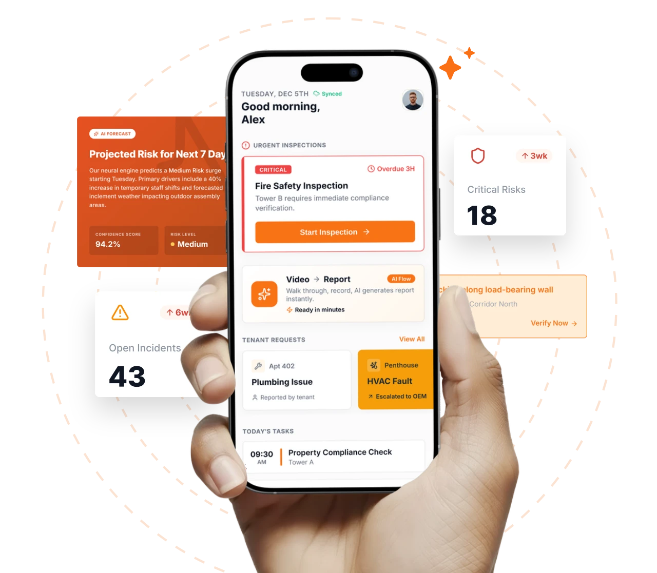
Inspectly360's Edge AI is trained on infrastructure defect types, including corrosion stages, crack patterns, insulation degradation, vegetation encroachment, and structural fatigue indicators. It runs on the device, so inspectors get real-time suggestions in the field without uploading images to a cloud service. The inspector confirms or overrides each suggestion, keeping engineering judgement in control. Custom models can be trained for your specific asset types and inspection standards to improve accuracy on the equipment you actually operate. Because detection is consistent, a developing corrosion problem gets flagged the same way whoever is holding the phone, which reduces the variation you get when defect grading depends on individual experience. Findings feed condition trends so recurring deterioration is caught before the next outage.
How does Inspectly360 help with PHMSA and NERC compliance reporting?
Inspectly360 turns field inspection data into regulatory reports instead of leaving compliance teams to assemble them by hand. Pipeline integrity rounds, substation inspections, and cathodic protection readings are captured on standardised templates aligned to PHMSA and NERC CIP requirements, with photos, GPS, and timestamps on every record. Because the data is structured and centralised, a compliance report can be generated from completed inspections rather than rebuilt from scattered notebooks and emails. The platform also tracks which scheduled inspections are complete, overdue, or missed, so a gap is visible before it becomes a violation. That matters when a single missing inspection can carry a significant penalty. Auditors and regulators get a consistent, evidenced trail per asset, and your team spends its time on inspections rather than on reconstructing paperwork.
Can Inspectly360 manage inspections across thousands of distributed assets?
Yes. Inspectly360 is designed for asset bases spread across wide geographic areas. Each asset carries its own inspection history, condition trend, and schedule, and risk-based scheduling lets you prioritise inspections by asset criticality, condition, and regulatory deadline rather than treating every asset the same. Inspectors are deployed efficiently because the platform shows what is due and where. Dashboards roll condition data up across the entire portfolio so engineering and compliance leaders can see emerging risk without waiting for regional reports. Critical findings trigger immediate alerts with escalation chains, so a serious safety issue on a remote asset reaches the right person quickly. This keeps inspection quality and scheduling consistent whether you operate dozens of assets or many thousands.